IDRE Sandbox
  • Projects
  • News
  • Workshops
  • Tutorials
  • Tools
  • Remote Consulting

Tag Archives: news

Links: Self learning: http://www.esri.com/training/main/training-catalog/course-recommendations This Tutorial: http://sandbox.idre.ucla.edu/?p=531 Data Visualization: http://selection.datavisualization.ch/ Social Explorer: http://www.socialexplorer.com/ Outline: Part I –…

  • CHIS GIS Workshop

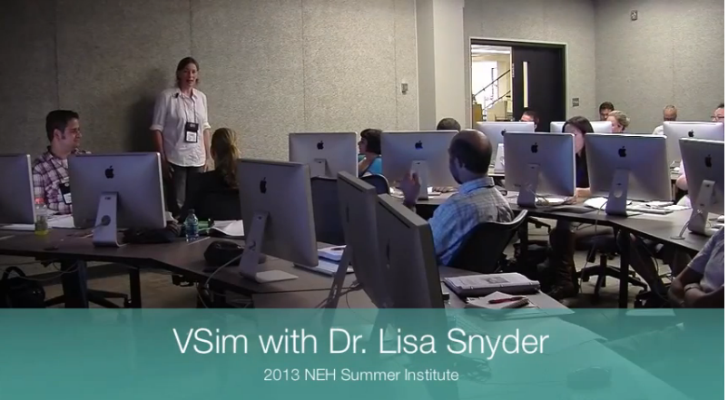
How would you like to model 3D environments and annotate them? Well, Sandbox visualization maestro Lisa…

  • VSim Modeling!
kendama's come in all sizes

2014 promises to bring bigger (and at times smaller) things to our exciting sandbox crew.  On…

  • Swinging into the new year
UCLA Magazine: Contant Content Humanities Go Digital

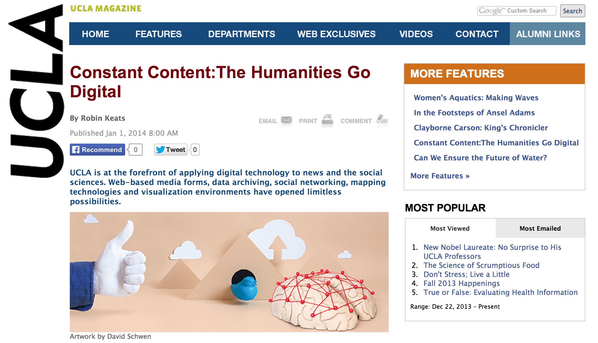
The UCLA social media brain trust (we really need to come up with a catchy name…

  • Todd, Dave, Francis and Yoh in UCLA Magazine
Miriam in the Chronicle

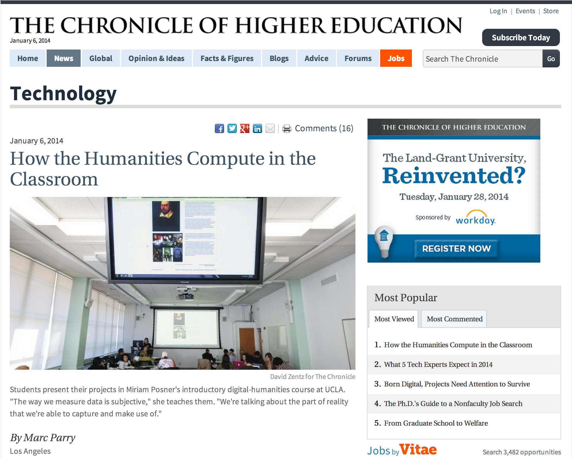
Yeah to our very own Miriam (who is not only an amazing Digital Humanist, but an…

  • Miriam and the Digital Humanities in the News!

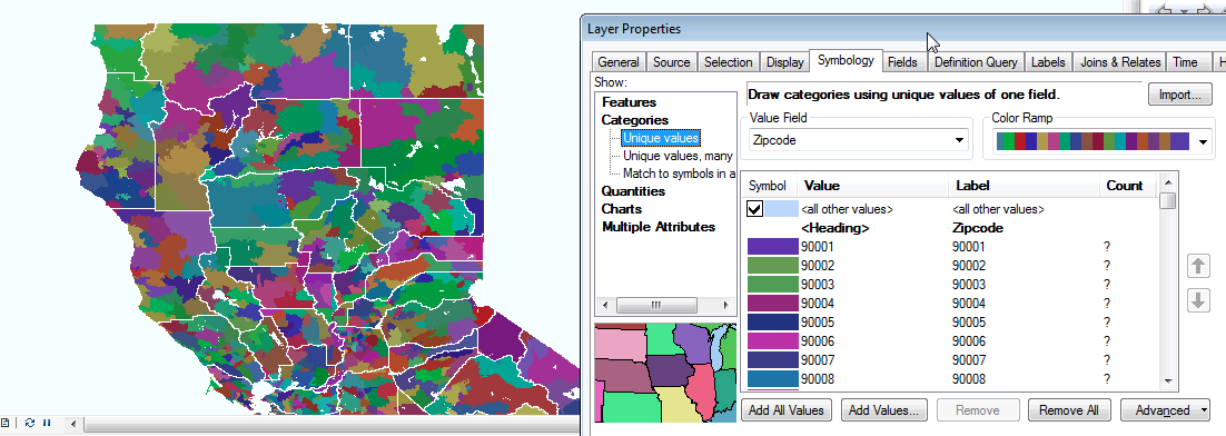
When displaying a georeferenced raster image in ArcMap that has a lot of line art, the…

  • Can ESRI preserve line quality at all?

[full screen]…

  • This week’s wow maps

[full screen]…

  • Mapping Tokyo

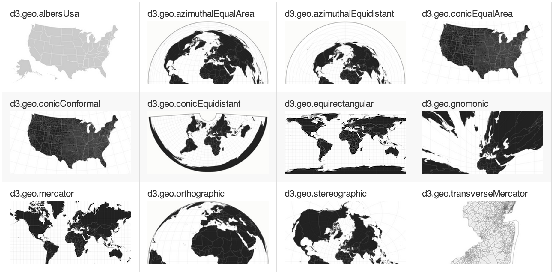
Mercator has been around for almost 500 years, but interestingly, it has almost single-handedly dominated the…

  • The changing front on digital maps on the web? A look into D3 Geo

What do you do when you are stuck at LAX because of a gunman?  Well, tweet…

  • Tweeting from LAX
Older posts
Page 3 of 5
Newer posts

Meta

  • Log in
  • Entries feed
  • Comments feed
  • WordPress.org
  • #8529 (no title)
  • A GIS Intro: Building an elections results map
  • Adding Media Content to a Google MyMap Infobubble
  • Advanced Practical Python #1: Getting Warmed Up
  • Advanced Practical Python #2: Dictionary2csv
  • Advanced Practical Python #3: File Data Visualization
  • Advanced Practical Python #4 Sentiment Shakespearean Analysis
  • Advanced Practical Python for Automation and Data Visualization
  • Albert Kochaphum – IDRE
  • Albert’s Python Cookbook
  • Alumni Sandboxers
  • An Introduction to Digital Mapping for the Humanities
  • And now for something com-python-ly different…
  • And now for something completely different.
  • And now for something completely different…
  • ArcGIS in Archaeology: Working with 3 Dimensions
  • Artsteps: Building VR Exhibitions
  • Asian Migration and Global Cities: An Introduction to Mapping and Data Visualization
  • Basic Web Scrapin’ #101
  • Basics of Mapping for the Digital Humanities
  • Beyond the Digitized Slide: The Mapping Edition
  • Bishamon
  • Blog Archive
  • Building 3D data maps in Google Earth (PRO)
  • CartoDB Gallery
  • CartoDB Part 1: Getting Started
  • CartoDB Part 2: Working with your own data
  • Conversion of 3D Research Data into Interactive Learning Objects (PI: Diane Favro)
  • COVID-19 Maproom
  • Current Sandboxers
  • Department of Community Health Sciences GIS Workshop
  • DH 101 Mapping Workshop 2017
  • DH 199 Mapping and Boyle Heights
  • DH101 – Getting Started with Carto 2017
  • DH101 CartoDB Workshop
  • Digital Karnak
  • Digital Mapping – Part 1b: Social Explorer and ArcGIS
  • Digital Mapping Workshop – Part 3c: Hands-on Leaflet Tutorial
  • Digital Mapping Workshop Part 1
  • Digital Mapping Workshop Part 3
  • Digital Mapping Workshop: CartoDB and Beyond
  • Digital Roman Forum
  • Encyclopedia of Egyptology
  • Forensic Empathy: Mapping Diseased Migrants
  • General Story Map Workshop 2018
  • Geocode4free
  • GetLatLon
  • Getting Started with Google Tour Creator
  • Getting Started with Social Explorer and Exporting Data
  • Getting Started with Spatial Research
  • Google Earth Arc Maker
  • Google Maps? Nah, Leaflet it go.
  • Google Spreadsheets JSON Returner
  • History of Digital Mapping and Beyond
  • How to add your data to ArcGIS
  • How to view KML Network Links in Google Earth
  • Hypercities: The Book
  • Intro to GIS, An Archaeological Perspective
  • Intro to GIS: An Archaeological Perspective
  • Intro to GIS: An Archaeological Perspective Part 2
  • Intro to GIS: Got data? Let’s map it!
  • Intro to Maps: History and Beyond
  • Introduction to GIS (Tokyo)
  • Introduction to GIS Training 2016
  • Introduction to GIS Workshop 2015
  • Introduction to Python 2018
  • Introduction to Python Summer 2019 for Engineering
  • Introduction to Spatial Data
  • Lisa Snyder – IDRE
  • Mapping Open Data
  • Matlab vs Python
  • Meet the Sandboxers
  • MXD Data Source Replacer
  • My Calendar
  • My Posts
  • Namie City, Fukushima
  • Open Data and Tableau
  • Palladio Workshop
  • Part 2b – Utilizing GPS Data: Tutorials
  • Project Home Page
  • Projects Test Page
  • Python and the Web
  • Python and Visualizing Data 2018
  • Python and Web Scraping 2018
  • Python Basics 2017
  • Python Scraping 101
  • Python Scripts
  • Python, Scraping, and Border Mapping
  • Request a workshop/training
  • Research and Pedagogy in 3D
  • Sample Page
  • Sandbox Calendar
  • Sandbox Geocoder
  • Scrapy Tutorial
  • Selenium Test
  • Session 2 – “Mapping Applied: Earth Day Lightning Talks”
  • Social Explorer Tutorial
  • Spatial Economics Workshop Series
  • Spatial Economics Workshop Series: Network Analyst
  • Spatial Ethnography Workshop – Part II
  • Spatial Statistics: Central means and directional distributions
  • Spatial Statistics: Hot spot analysis
  • Spatializing Data with R
  • Spring 2015: Digital Mapping Workshop Series
    • Digital Mapping Workshop – Part 3b: Energy Atlas
  • Spring 2016 Mapping for Research Series
  • Spring 2017 Research Data Visualization Series
  • Spring Digital Mapping Workshop Part 2: GPS
  • Summer GIS Workshop 2018
  • Test
  • Test
  • The Visualization Portal
  • Thinking Spatially
  • Top web mapping technologies for research
  • Tutorials
    • Google Maps? Nah, Leaflet it go.
  • UCLA GIS Day
  • UCLA GIS DAY 2016
  • UCLA GIS DAY 2017
  • UHI Adobe Premiere Workshop Outline
  • UHI Story Map Workshop 2017
  • Understanding Mothers: An Interview with Film Maker Hitomi Kamanaka
  • Use 360° Photos to Create a “Tiny Planet”
  • VSim
  • VSim: An Interface for Academic 3D Models
  • Web Scrapin’ Focus on Python
  • Where is the Sandbox?
    • Now Institute GIS Workshop
  • Workshop data
  • Workshop Part 1: Got Data?
  • Workshop: Creating a Google Map “Mash-up”
  • Workshop: How to map your data with Google Fusion Tables and ArcGIS
  • Workshop: Network Analysis Part 2
  • Workshop: Spatial Analysis
  • XR Tools & Resources for Getting Started
  • Yoh Kawano – IDRE
  • Zig

Free WordPress Theme designed by Gavick.com

Proudly published with WordPress

In response to COVID-19 the Sandbox is providing weekly open office hours for research consulting and questions.

Learn more
X